As part of my work at Yaar Architects, I participated in the development of master plans, detailed plans, and strategic plans for urban renewal. In these projects, I led the planning of employment and industrial zones through the lens of the Fourth Industrial Revolution, where industry serves as a key driver of growth. Additionally, I contributed to urban renewal initiatives, from the strategic level down to detailed plans.
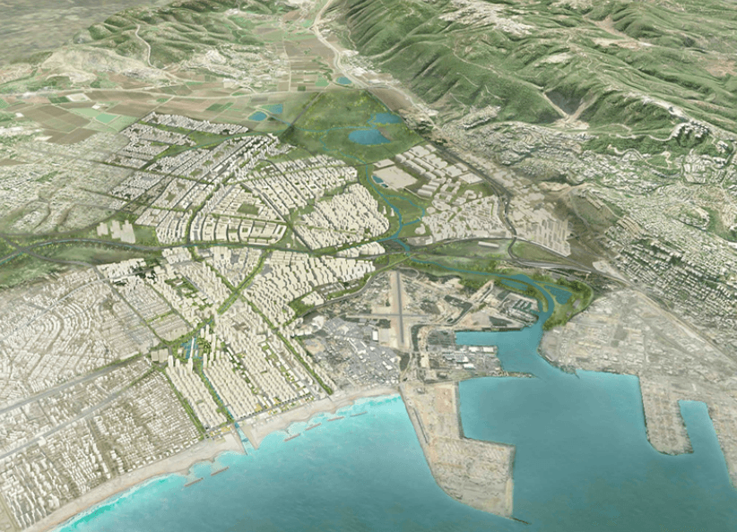
National Master Plan for Haifa Bay “Gateway to the Bay” (TAMA 75)
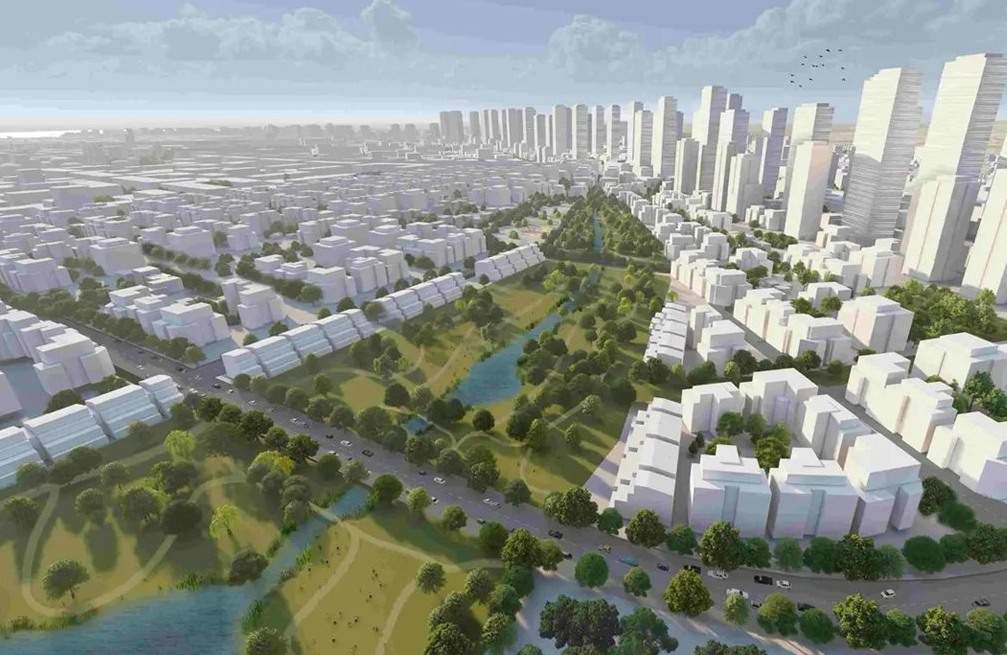
The plan outlines the future transformation of Haifa Bay, creating a continuous urban connection between the Krayot and the city of Haifa, and establishing links to employment centers across the region. The goal is to strengthen the Haifa metropolis and balance residential, commercial, and industrial areas while reducing private vehicle usage and ensuring local residents have access to open spaces. Additionally, the plan designates future land uses for housing and employment on the industrial sites and secures a high-quality metropolitan park spanning 5,300 dunams (approx. 1,300 acres), centered around the Kishon River and connected to the downstream Kishon Park.
The “Gateway to the Bay” plan (TAMA 75) is a master plan for regional development that serves as a foundation for more detailed planning. Its main objectives include establishing a land-use framework—covering residential areas (with 100,000–130,000 housing units), employment, commerce, industry, logistics, open spaces, and infrastructure—and formulating guidelines and directives for the preparation of detailed plans.
Detailed Plan for Haifa Bay
The Bay Plan encompasses approximately 102,000 residential units, public buildings, around 11 million square meters for employment and commerce (in addition to about 2.7 million square meters in Kiryat Ata), around 5 million square meters for industry, a 650-dunam (approximately 160-acre) logistics park, and about 3,500 hotel rooms. Within the open spaces, a metropolitan park of approximately 6,000 dunams (about 1,480 acres) is planned. The area currently hosts around 145,000 jobs, and the plan’s potential increases this figure to about 760,000 jobs across a wide range of sectors.
The territory is divided into four zones, balancing residential, employment, and industrial areas in a way that ensures a high-quality living environment, free from nuisances, while also reducing reliance on private vehicles and guaranteeing residents access to open spaces. This is achieved by incorporating innovative approaches to parking, energy conservation, walkability, and urban heat management.
As part of the plan’s development, Yaar Architects was tasked with planning the second zone. The second zone includes the existing axis of Halutzei HaTaasiya Boulevard, which starts near the industrial area by Haifa Bay Port and extends to the Yagur junction. It is defined as the “Metropolitan Center Axis.” Halutzei HaTaasiya Boulevard will be the main boulevard connecting the future metropolitan park, stretching from the Yagur junction all the way to the sea.
Komemiyut–Yaski Complex | TAML 2014
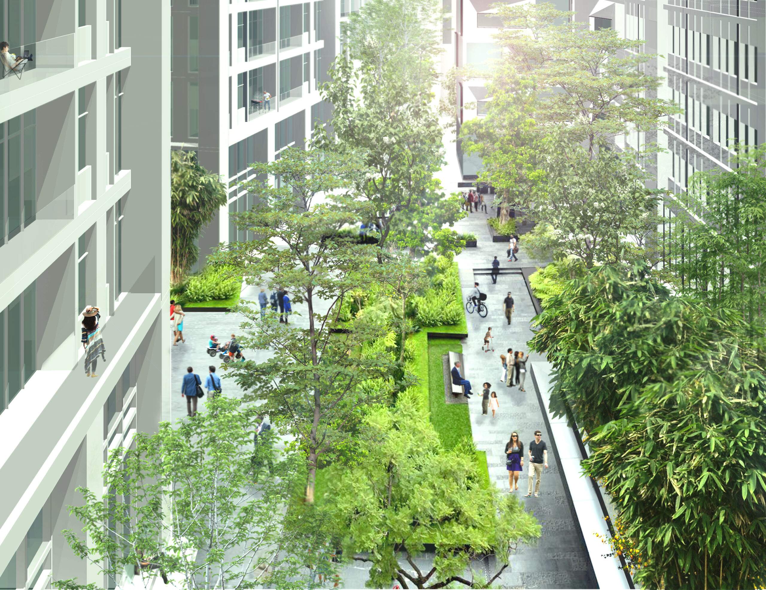
An urban renewal plan in the Komemiyut–Yaski complex in the heart of Kiryat Gat, based on the “Pinui-Binui” (evacuation and reconstruction) model. Located along major thoroughfares—Ha’atzmaut, Tzahal, and Komemiyut Boulevards—the plan envisions the development of a vibrant urban center featuring a mix of uses: commercial, employment, public areas, and residential, with active frontages lining the boulevards.
An additional 1,450 housing units are planned on top of the existing 144 units, for a total of 1,564. Of these, 312 will be small apartments.
The plan proposes a mixed-use development comprising commercial, employment, public spaces, and residential uses, with active commercial frontages along the main boulevards.